該檔案來自於維基共享資源,它可能在其它計劃項目中被應用。
它在檔案描述頁面那邊上的描述於下面顯示。
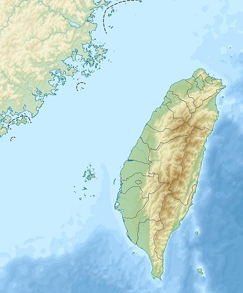
 | 這張圖片需要更新,因為:The earlier forms of this map did not extend a dotted-line around Dongyin, Lienchiang (Tungyin). The northern edge of this map ought to be moved up a little bit (in latitude) so that a dotted line encompassing Dongyin (Tungyin) can be clearly drawn and so that we can see a few of the islands north of Lienchiang County in Haidao Township, PRC. Example of a better map from The Economist: [1].在這樣做的時候,您可以為該圖片加入時間戳。
- 請透過
{{subst:update-note|1=File:Taiwan relief location map.jpg|2=The earlier forms of this map did not extend a dotted-line around Dongyin, Lienchiang (Tungyin). The northern edge of this map ought to be moved up a little bit (in latitude) so that a dotted line encompassing Dongyin (Tungyin) can be clearly drawn and so that we can see a few of the islands north of Lienchiang County in Haidao Township, PRC. Example of a better map from The Economist: [2].}} ~~~~
|
摘要
授權條款
我,本作品的著作權持有者,決定用以下授權條款發佈本作品:
- 您可以自由:
- 分享 – 複製、發佈和傳播本作品
- 重新修改 – 創作演繹作品
- 惟需遵照下列條件:
- 姓名標示 – 您必須指名出正確的製作者,和提供授權條款的連結,以及表示是否有對內容上做出變更。您可以用任何合理的方式來行動,但不得以任何方式表明授權條款是對您許可或是由您所使用。
- 相同方式分享 – 如果您利用本素材進行再混合、轉換或創作,您必須基於如同原先的相同或兼容的條款,來分布您的貢獻成品。
https://creativecommons.org/licenses/by-sa/3.0CC BY-SA 3.0 Creative Commons Attribution-Share Alike 3.0 truetrue

|
已授權您依據自由軟體基金會發行的無固定段落、封面文字和封底文字GNU自由文件授權條款1.2版或任意後續版本,對本檔進行複製、傳播和/或修改。該協議的副本列在GNU自由文件授權條款中。http://www.gnu.org/copyleft/fdl.htmlGFDLGNU Free Documentation Licensetruetrue
|
檔案歷史
點擊日期/時間以檢視當時出現過的檔案。
| 日期/時間 | 縮圖 | 維度 | 使用者 | 註解 |
|---|
| 目前 | 2019年9月19日 (四) 22:01 |  | 1,016 × 1,222(101 KB) | Geographyinitiative | temporary fix: extending the boundary out around Dongyin Township (as in China Fujian2 location map.svg and as in File:Nationalist China - administrative divisons. LOC 2007633622.jpg) |
連結
此檔案中包含有擴展的訊息。這些訊息可能是由數位相機或掃描器在建立或數位化過程中所增加的。
如果此檔案的源檔案已經被修改,一些訊息在修改後的檔案中將不能完全反映出來。


