檔案:BlankMap-Americas.svg

出自六年制學程
跳轉到: 導覽搜尋
BlankMap-Americas.svg(SVG 檔案,表面大小:384 × 387 像素,檔案大小:626 KB)

該檔案來自於維基共享資源,它可能在其它計劃項目中被應用。 它在檔案描述頁面那邊上的描述於下面顯示。

描述

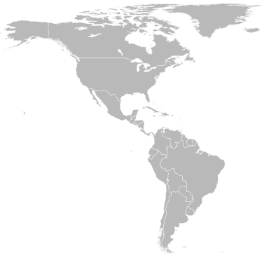
A blank Robinson-projection map of the Americas centered at the 100W longitude line.

Detailed SVG map with grouping enabled to connect all non-contiguous parts of a country's territory for easy colouring. Smaller countries can also be represented by larger circles to show their data easier.

A thorough description of use and other instructions relating to can be found on the instruction page
日期
來源 Based on Image:BlankMap-World6.svg and rotated using the pythonscript available at http://gsl-nagoya-u.net/appendix/software/worldmap/
作者 Lokal_Profil
授權許可
(重用此檔案)

The map data manipulated by the script is in the public domain. The raw output of the script, including the file shown here, is also in the public domain.

Public domain 我,此作品的版權所有人,釋出此作品至公共領域。此授權條款在全世界均適用。
這可能在某些國家不合法,如果是的話:
我授予任何人有權利使用此作品於任何用途,除受法律約束外,不受任何限制。
其他版本 Derivative works of this file:  Polychrotidae - distribution.png

說明

添加單行說明來描述出檔案所代表的內容

在此檔案描寫的項目

描繪內容

image/svg+xml

b85ef01af6a76c82f73940ea876a05e6ea5cb1ef

斷定方法:​SHA-1 中文 (已轉換拼寫)

640,990 位元組

387 像素

384 像素

檔案歷史

點擊日期/時間以檢視當時出現過的檔案。

日期/時間縮圖維度使用者註解
目前2008年4月28日 (一) 02:22於2008年4月28日 (一) 02:22的縮圖版本384 × 387(626 KB)Lokal ProfilRemoved all the hidden objects to reduce file size. Also removed sodipodi and inkscape tags

以下的1個頁面連接到本檔案: